
August 7, 2024 - The Necessity of Radar in Fighting Megafires
Here on the west coast, we’ve experienced multiple of the deadliest fires on state record in the past half-decade alone. It doesn’t take a specialist to notice the patterns that enable each consecutive devastation - drought, heat waves, and high winds have permanently hammered their way into weather forecasts.
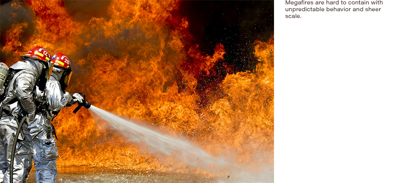
What’s more alarming is that specialists were also muddled, through no fault of their own. The megafires that continue to torment the west have defied known fire behavior and thus diminished the efficiency of age-old fire fighting tactics. To regain footing, technology and data acquisition is vital. Radar is one such tool that has already proved its worth in predicting, detecting, and fighting fires. Its evolution is critical to lessen the threat of such devastation.
High winds, dry air, and high temperatures present the ideal environment for fires to trigger and grow (NWS). The turn of the century has only elevated those perfect conditions. Drought has dried out trees and made even the most fire-resistant trees vulnerable; nights have warmed by a whopping 28%, and the coast has experienced a 33% loss in fog (Cart, J). The fuel is there and ready to burn - so reliable weather forecasts are more pertinent than ever to ensure the correct preparations are taken from an individual to a national level. Though it’s still not enough.
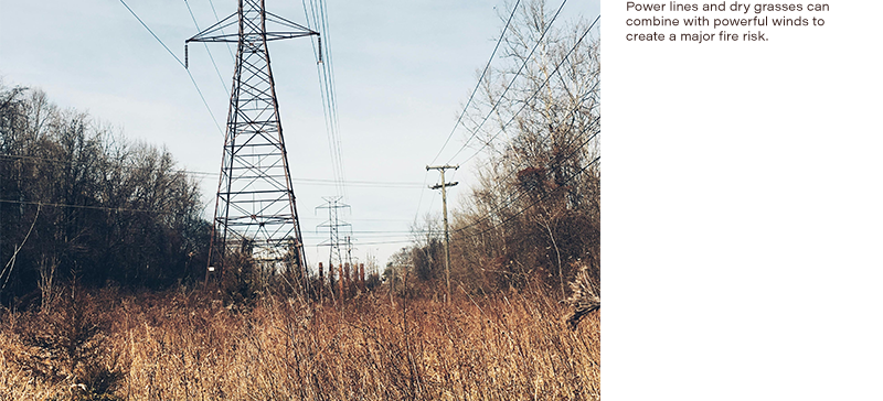
A utopian solution would be to eliminate all fire catalysts. Seeing that 90% of wildfires are caused by humans, that solution is even more agonizing (Wfca). Campfire restrictions, limited access to roads in proximity to highly flammable fuels and/or high winds, power shut offs, and other precautionary measures are already in place. Yet the harsh reality is that eliminating human causation requires 100% diligence for all parties involved. That’s just not feasible.
Several major solutions remain: cracking down on regulations, and beefing up fire-fighting tactics and tools to maintain a front against the radical behavior of megafires. All eyes are on tech.
Understanding weather, climate, terrain, and fuel sources dictates evacuations, front-line management, and fire growth predictions. A combination of weather radar, satellite imagery, drones, infrared mapping and more make up the tool belt that’s become necessary for wildfire management. Real-time monitoring combined with models developed from known fire behavior, flammability of vegetation, terrain, etc. helps to predict fire behavior (FRAMES). The issue is that these models are becoming outdated or inaccurate as fires are becoming unpredictable. There is hope, because masked by unpredictability may just be a series of unknowns that can be solved with better technology and in turn - better data.
Weather forecasting is now quicker, more accurate, and can provide more advanced readings. A state-of-the-art weather radar developed by a team at Oklahoma University does just that. It utilizes phased array radar, which has a much larger scope than Doppler radar (DeLozier, J.). Seeing as the leading cause of wildfires next to human activity is lightning strikes, improved weather forecasting can ensure that resources are at the ready. In the face of a fire already gone rogue, predictions of rain, humidity, and cold fronts not only offer solace but are a massive asset. Every moving part counts.
Radar is also used to study the fires themselves. A team at San Jose State University has a new portable radar system that’s shed light on fire behavior - with a new wavelength, this radar can provide a more detailed view of the inner workings of fires than Doppler radar (CBC Radio). When fires can spread from a spark to a massive flame within seconds, each bit of knowledge helps.
So what are the efforts behind radar, and what equipment is moving along its evolution? In truth, there’s a whole slew of equipment used to push the bounds of radar capabilities. Driving factors equally demanding as fire safety provide the motivation necessary to break barriers and help build a front to curb the footprint of catastrophes caused by megafires.
Arbitrary waveform generators, RF/microwave signal generators, and RF power sensors are several technologies in the realm of radar that have seen steady advancements. AWGs have reached a pinnacle of innovation by reaching such high frequencies that some models can be used for radar applications. RF/micro signal sources and RF power sensors are traditionally used for radar, and there's a wide variety of equipment with different niche specifications. No matter the application, the domino effect of innovation is powerful.
Citations
Cart, J. (2020, September 28). California’s ancient ‘asbestos’ forests no longer seem immune. CalMatters. https://calmatters.org/environment/2020/09/california-asbestos-forests-n....
Cart, J. (2023, July 12). Drones, satellites and AI: How California fights its unpredictable wildfires with analytics. CalMatters. https://calmatters.org/environment/wildfires/2023/07/california-wildfire...
FRAMES. (2024, March 13). FARSITE. Fire Research and Management Exchange System. https://www.frames.gov/catalog/908
CBC Radio. (2019, November 15). New high-powered radar gives scientists a 3D view of wildfires in real time. CBC. https://www.cbc.ca/radio/quirks/nov-16-watching-wildfire-with-radar-the-...
NWS. (n.d.-a). Fire Weather program background information. National Oceanic and Atmoshperic Administration. https://www.weather.gov/fsd/fireback#:~:text=Up%2Dto%2Ddate%20weather%20....
DeLozier, J. (2023, October 10). OU deploys the world’s most advanced weather radar. OU Research. https://www.ou.edu/research-norman/news-events/2023/ou-deploys-the-world...
WFCA. (2024, March 4). What causes wildfires? WFCA. https://wfca.com/wildfire-articles/what-causes-wildfires/#:~:text=Humans....